In photos: Cederberg dusts off the ash
Nature reserve reopens after massive fire
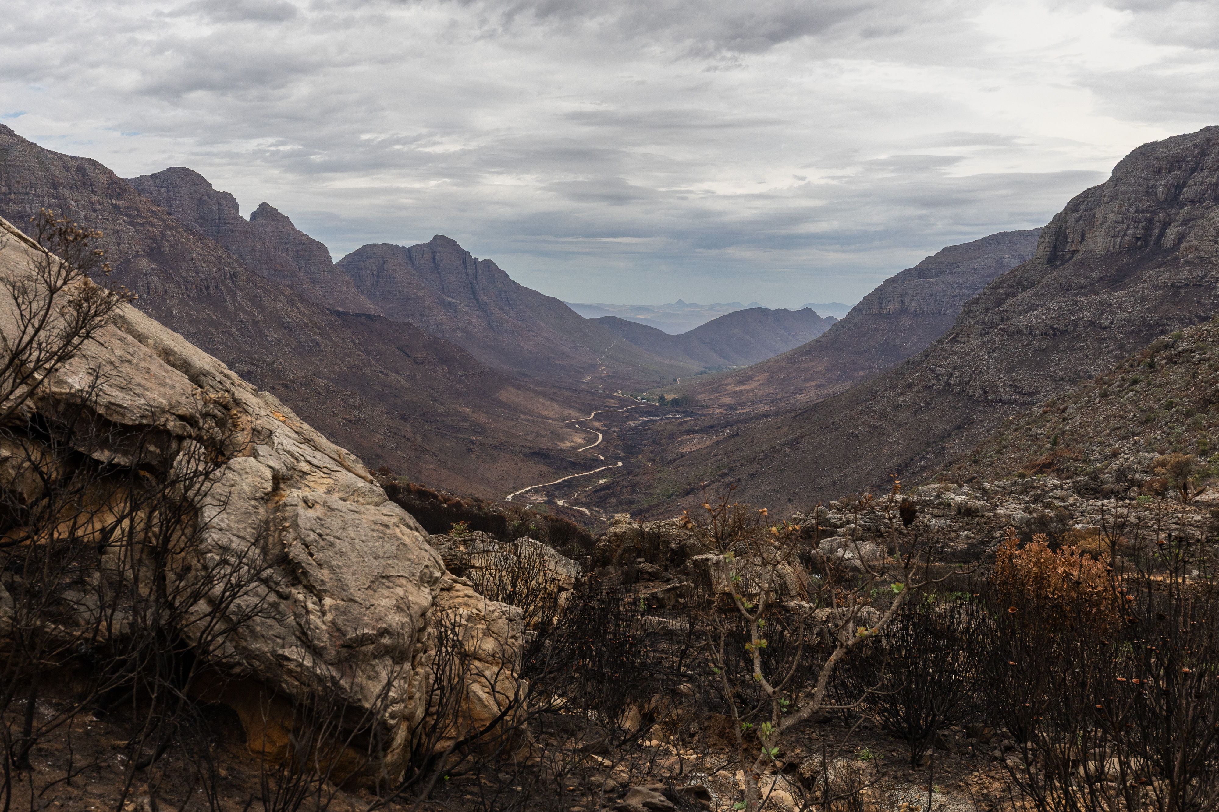
A view from Uitkyk pass, near where a vehicle caught on fire, starting a runaway fire through the Cederberg for two weeks.
Two months ago, a wildfire tore through central Cederberg, burning an estimated 53,000 hectares of mountain wilderness.
The fire started on 22 December and burned for about two weeks before being brought under control on 5 January. It devastated tourism, businesses and farmers in the region. It was one of the biggest fires the Cederberg has seen in recent years.
Monique Ruthenberg, CapeNature conservation manager, says the biggest losses from the fire were economic because the Cederberg Nature Reserve had to close to tourists.
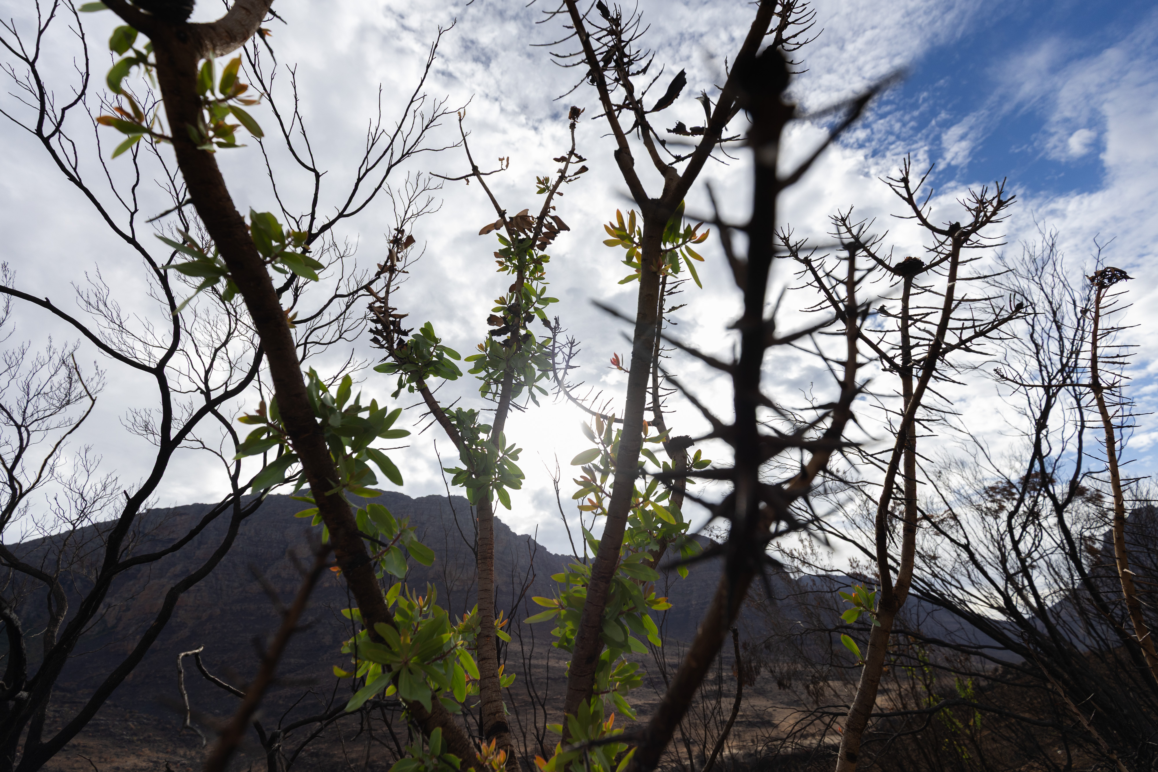
Signs of regrowth are already visible.
Some areas of the reserve have now started reopening, including Stadsaal, Truitjieskraal, Kromrivier, and Driehoek. But the Algeria campsite and several hiking trails and wilderness areas remain closed while damage assessments are done.
Considering the scale of the fire, the losses were relatively minor, said Ruthenberg.
Vegetation around Stadsaal Caves and Truitjieskraal was burned to the ground, but fortunately, centuries-old Khoi and San rock art remain intact.
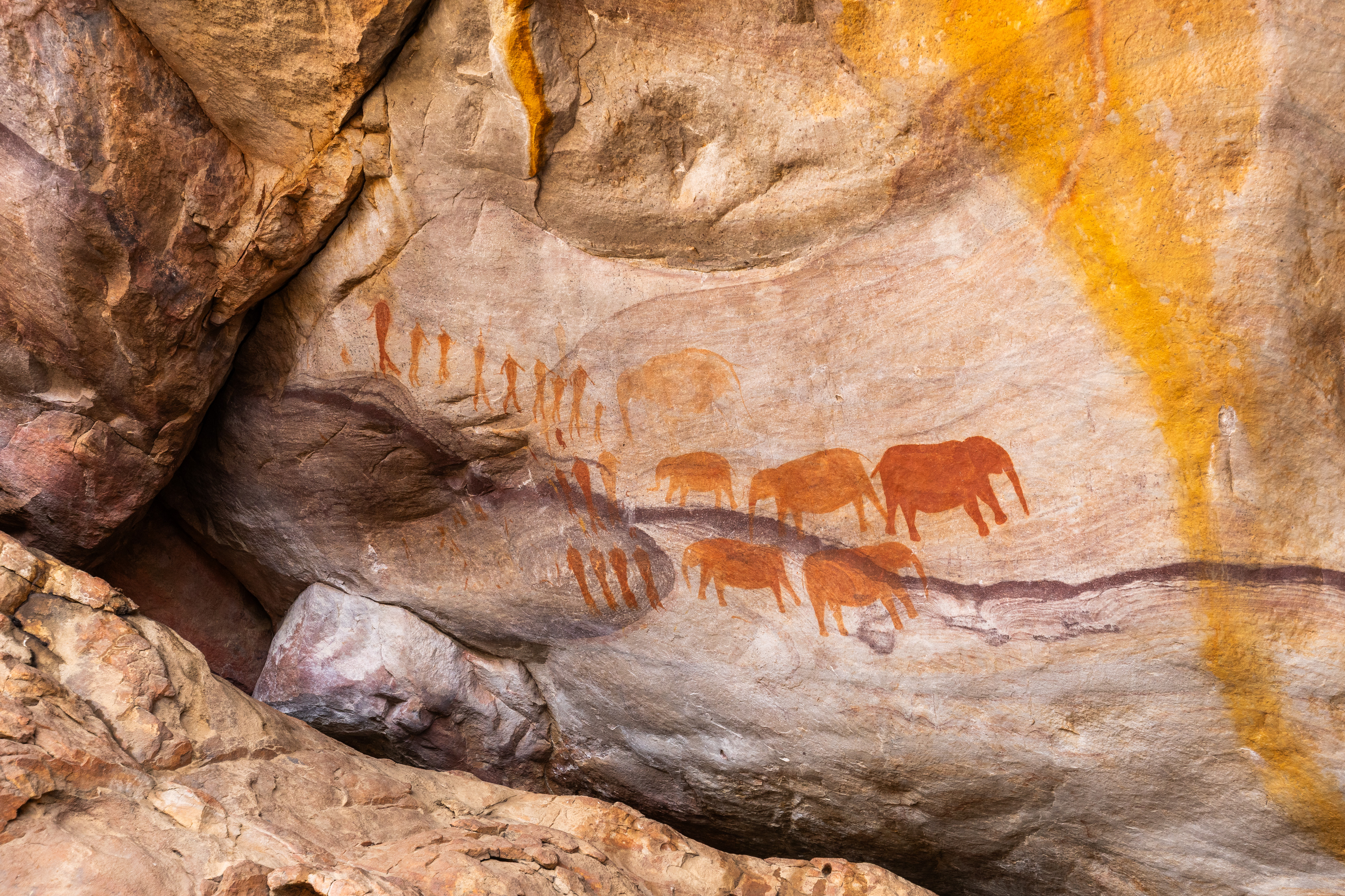
Rock art at Stadsaal was not damaged in the fire.
The fire started after a vehicle caught alight on the Uitkyk pass, near the CapeNature Algeria campsite.
“We had a very strong wind that afternoon, very hot temperatures. We hadn’t had rain for a month, so the conditions were just ideal for a big fire,” said Monique Ruthenberg, CapeNature conservation manager.
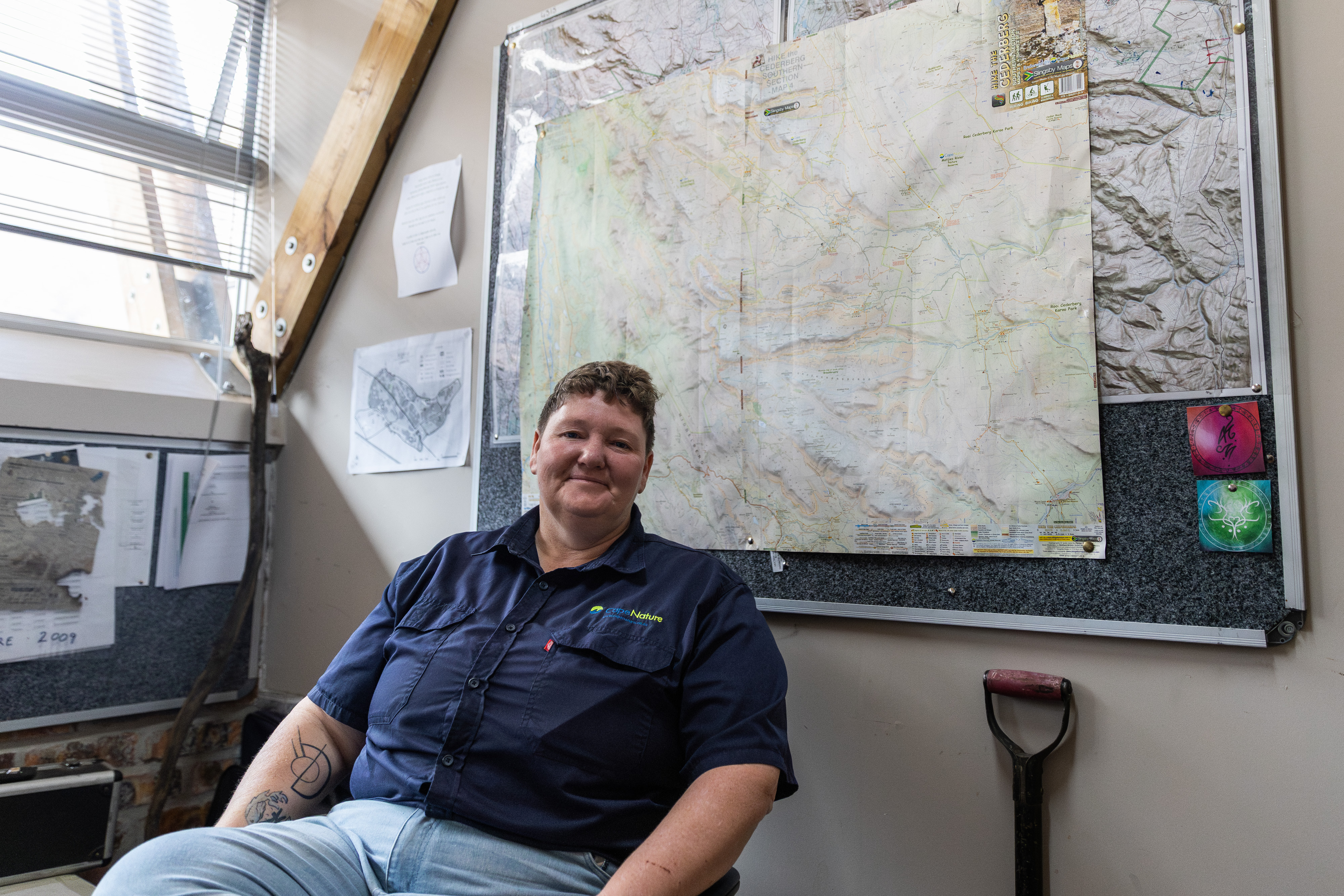
CapeNature conservation manager, Monique Ruthenberg, in her office in Algeria.
The Cederberg mainly consists of fynbos vegetation, which require fires every decade or two for rejuvenation. Some of the fynbos had not burnt for many years, said Ruthenberg.
At its peak, about 200 people worked to extinguish the fire.
“You play chess with this fire,” says Ruthenberg. “Anticipating where it’s going, watching the fire movements, watching weather conditions.”
Work has begun on fixing exposed pipes, infilling and erosion, trail maintenance, cleaning up burnt campsites, and managing invasive plants.
In 2023 and 2024, the area experienced several devastating floods, which also caused widespread damage.
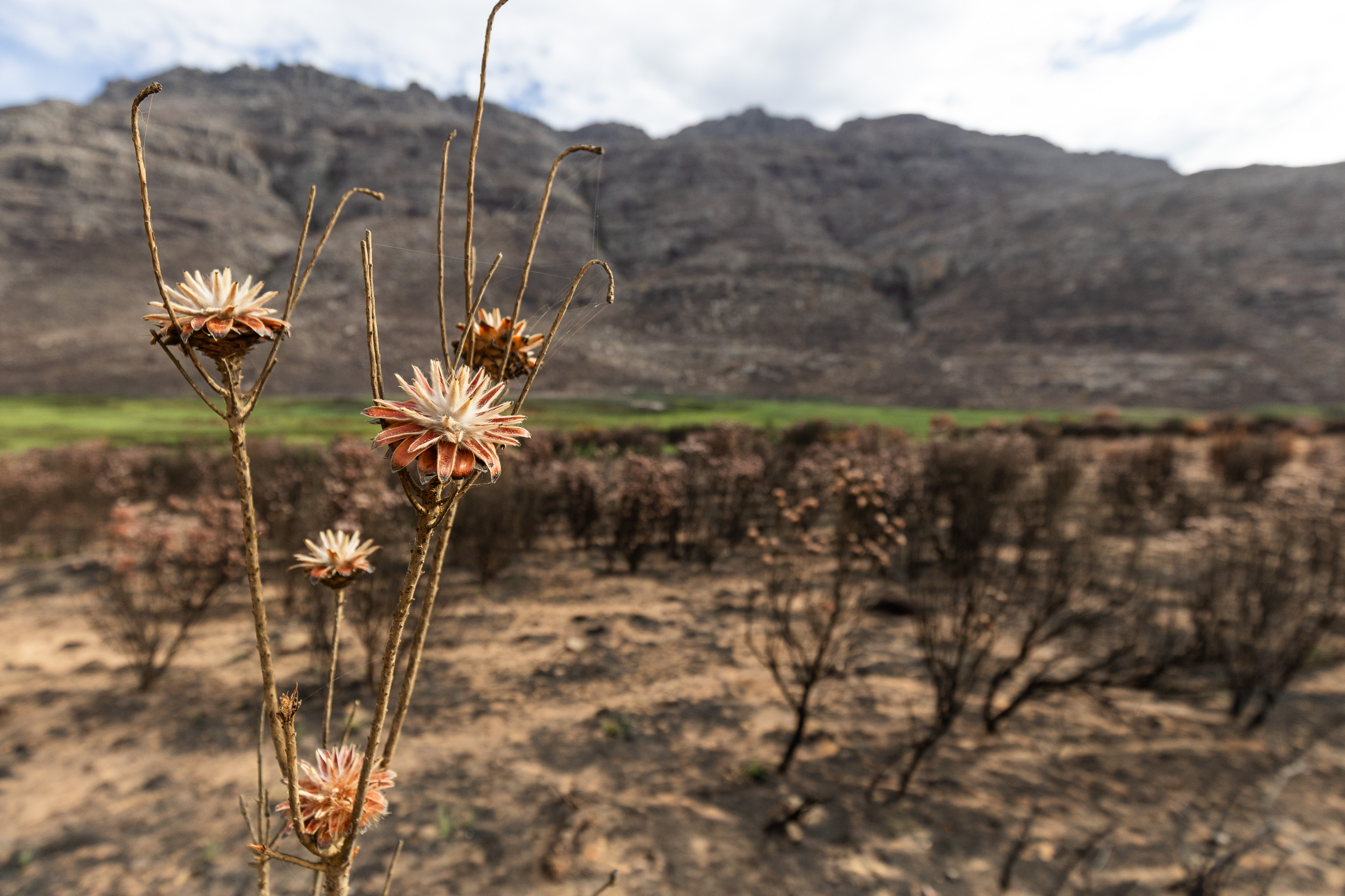
A burnt Spinning Top Conebush (Leucadendron rubrum).
Support independent journalism
Donate using Payfast
![]()
Don't miss out on the latest news
We respect your privacy, and promise we won't spam you.
Next: Despite President’s promise, Joburg protesters say they still have no water
Previous: IEC commits to make voting easier for people with disabilities
© 2026 GroundUp. This article is licensed under a Creative Commons Attribution-NoDerivatives 4.0 International License.
You may republish this article, so long as you credit the authors and GroundUp, and do not change the text. Please include a link back to the original article.
We put an invisible pixel in the article so that we can count traffic to republishers. All analytics tools are solely on our servers. We do not give our logs to any third party. Logs are deleted after two weeks. We do not use any IP address identifying information except to count regional traffic. We are solely interested in counting hits, not tracking users. If you republish, please do not delete the invisible pixel.