Walking Joburg’s biggest baddest river: boerboels and cable thieves
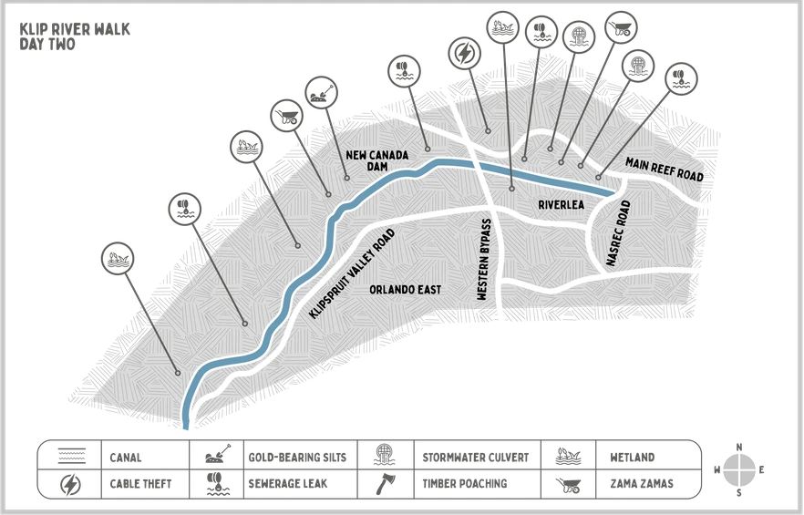
Day 2 on the Klip River: Riverlea to Soweto
Map: Lotte Manicom/Surefire Communications
As the magnitude of Johannesburg’s water crisis becomes clear, water authorities are beginning to look at what it would take to use water from alternative sources, including the water running in Joburg’s own rivers. To gauge the feasibility of this, GroundUp took a three day walk along Johannesburg’s Klip River. On the second day, our guides were Klaas Mhlongo, itinerant Rastafarian and Loyiso Maquina, biokineticist and breeder of boerboels.
Walking Joburg’s biggest baddest river
This article is part of a three-part series.
Part one: Gold dust and gunk
Part two: Boerboels and cable thieves
Part three: A very old church and a mermaid
“It might be very tense in Riverlea,” Klaas Mhlongo warned.
He had recently moved into a backroom in a neighbouring community, and knew that skirmishes between rival gangs of Zama Zamas (informal miners) had intensified recently in the nearby informal settlement of Zamimphilo. On the worst day of violence, five people had died. Fed-up Riverlea residents had occupied the streets shortly after, drawing the attention of the then Minister of Police, Bheki Cele, who made a site visit and promised swift action. “Specialised” police units had been duly deployed, and nearly 100 arrests had been made.
We would be walking in the tense aftermath of all of this, but Mhlongo did not seem fazed.
“If you choose to walk along this river, people will assume you are dangerous, or crazy. Either way, they will leave us alone.”
We parked at the Sasol garage on Nasrec Road, and continued on foot, crossing over into Riverlea’s river-inspired street grid: Colorado branching onto Pongola, Pongola tumbling down to Potomac, and then on into Ganges and Jukskei.
On Molopo Street a man in a black golf shirt greeted us and said, “Is julle kort iets?” (“Are you short of something?”)
Riverlea makes the news for all the wrong reasons: seasonal flooding, sanitation ruptures, substance abuse, pulmonary issues connected to the nearby mine dump, illegal mining and a high rate of violent crime. Photos: Sean Christie
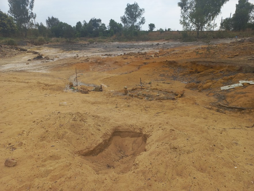
A large tailings dam sits above the far end of Riverlea, extending some way down river. Walking in its shadow we came to a band of orange soil that had spilled out of the dam, like mud left behind after a flash flood. Two little graves humped the middle area, and a third had been dug but left empty.
Mhlongo eyed the mounds hopefully, and said, “I think it’s dogs - some people really love their dogs.” Little crosses made from tied-together sticks stuck out of the mounds. A mole had pushed up little hills in the space between.
Little graves, dug into a land spill from a slimes dam on the edge of Riverlea.
We continued over the land slip and stopped short again. Dangling down from a stout eucalyptus was a belt. Mhlongo mumbled “This is no kind of place”. A police helicopter passed low above the treetops.
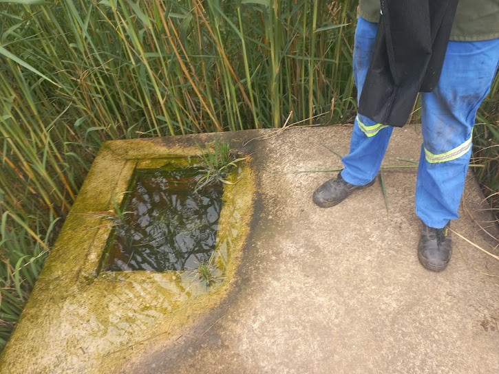
We continued around the base of a ridge that lichen had turned lime green. It was pleasant walking now – the path was well-defined, and fountain grass brushed at our legs. We came to a wetland created entirely by leakage from a brick pumphouse. The inside of the pumphouse, when we clambered onto it, looked like an aquaculture display in a herbarium, filled with waterlilies and waving pond grasses. Mhlongo looked at the water flowing over our gumboots and said, “This was meant for people but it is leaking into the river, and the river goes away from the city.”
Long standing water leaks alongside the river have created artificial wetlands.
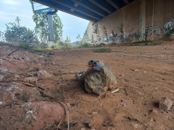
Now we followed the railway line, which tracks the river all the way to Soweto. The Western Bypass loomed above us and we saw that the underpass had been comprehensively plundered by copper thieves - cables that had been cemented into trenches in a vain safeguarding attempt had been pick-axed or perhaps even jack-hammered out, and only a few fist-sized bits of concrete remained, with the multicoloured cable casings still in them, like arteries in a heart.
Copper cable theft on an epic scale has crippled the Soweto-Johannesburg railway line
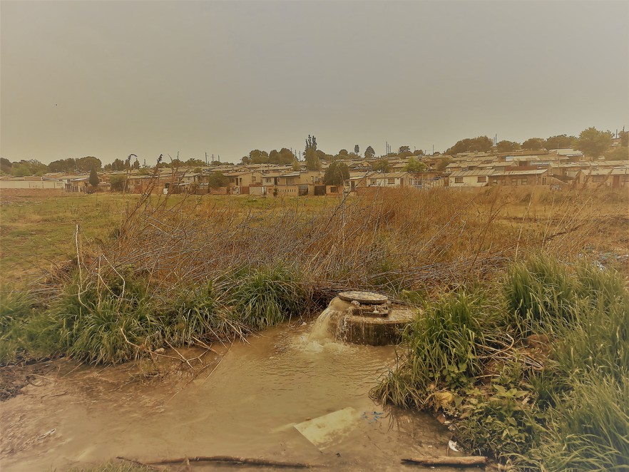
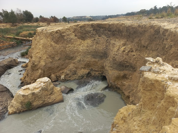
We rejoined the banks of the stream at the point at which its waters tumble down towards New Canada Dam, which once supplied water to Consolidated Main Reef mine. Sacred ibis – harbingers of rotten water - took flight, and we encountered the sewage spill around the next bend: a 300mm pipe jutting from the yellow embankment, from which grey-coloured sewage flowed. Gabion baskets that had once run the length of the embankment had curled away into the river, and the effluent was cascading into the gap that had opened between the rock-filled baskets and the riverbank. Carpets had been laid out in this space by sewage miners, to catch valuables dropped into the sanitation system.
We were not walking beside a stream so much as an open conduit for waste. To get away from its stench we climbed to higher ground and were able to see, for the first time, a complete view of the dam, which was empty – dewatered is the official term - covering an area the size of a city suburb. Like Crown Valley which we passed on day one, New Canada is another site of the Valley Silts Project, which aims to excavate and process gold-bearing silts that have accumulated in the course of a century of intensive gold mining. The dam was peppered with pyramids of sand around which the stream split and split again, forming a delta of black rivulets.
A large sewer line break decanting into the Klip at New Canada dam. Note the carpet placed in the flow by sewage miners, to catch items that have been dropped into the sanitation system in the Bosmont area.
From the north, the Bosmont Spruit joined our stream. It is a disreputable confluence. An analysis of water samples from the Spruit by the University of Johannesburg’s Process, Energy & Environment Technology Station (UJ-PEETS), found a whopping 4,000 microbiological elements in the samples, including a number of so-called ESKAPE pathogens, which are the leading cause of highly antimicrobial resistant infections. The analysis was done on behalf of Bosmont-based NGO Comm-unity Green Projects (CGP), which is using the information to identify, and work with, the primary polluters of the water.
At the southern end of New Canada Dam, we saw the place where floodwaters punched through the dam wall in 2010 - a large, empty U, through which the river flowed with force. GroundUp had previously spoken with Henry Gouws, the managing director of Ergo Mines, who has made regular helicopter flyovers of the area since 2002. In this time, he has observed the steady passage of silts down the valley, into New Canada Dam, “primarily a consequence of increased development in the catchment of the stream, resulting in vastly higher storm flow through these areas, which causes massive erosion”. As New Canada dam silted up, its ability to hold back floodwaters decreased, until finally, the dam wall gave in. At the same time, Ergo’s meticulous meteorological records indicate a rise in annual rainfall.
“It’s like things are coming together in a perfect storm, leading to major problems downstream,” he said.
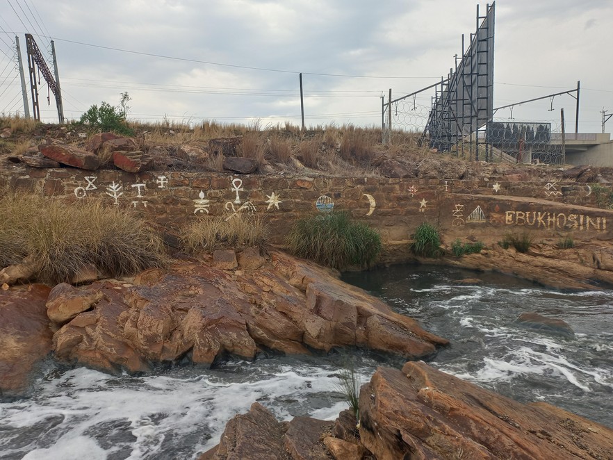
We followed the river down into Orlando, through a corridor of basalt rock that has been painted with Cyrillic markings by congregants of the Nazarite church. Colourful candles had melted down amongst the green, spiny grasses.
Nazarite congregants have daubed Cyrillic symbols on the rocky riverbanks above Orlando.
Walking down Klipspruit road, we spotted what appeared to be a man walking two dogs, but there was something wrong with the image: they were all impossibly big. Before we had time to think, the larger of the two dogs was upon us, rocking back on its haunches in an attempt to put its paws on our shoulders.
“Loverboy, no. Loverboy, stop,” the giant man yelled.
“Don’t worry, they’ve very placid, very well socialised,” he continued, wrestling Loverboy back to earth with the lead double-wrapped around his meaty hand.
“Loyiso Maquina,” said the man, issuing fist bumps. The dogs thumped against our legs.
“What are they?” Mhlongo asked.
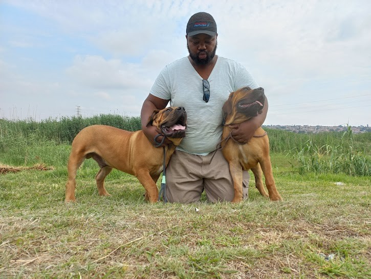
“Boerboel,” said Maquina, the founder and owner of Amayhira boerboels, based in Kliptown. Maquina invited us to walk with him, which refocussed our attention on the specific details of the riverbank, here an admixture of broken glass, rubble, wires and plastics. Old trenches that had never been backfilled made it difficult to walk abreast. The dogs jostled against each other and panted with soup-plate sized tongues.
Biokineticist and boerboel breeder Loyiso Maquina with his prize dogs.
We came slobbering towards the traffic circle that moderates the meeting of Klipsruit and Nancefield Morokoa roads. On the other side of a green pond a concrete billboard advertised Soweto Motel, against a backdrop of shacks.
“Nancefield Hostel, real Zulu place,” said Maquina. Shacks had grown up around the hostel, which had been built in 1951 to accommodate single Zulu men. The community, now comprising women and children, has experienced several floods in recent years. After 400 households were inundated in 2022, city officials declared that the affected homes were within the 100-year flood line, and no structures should be re-established in the same area. Maquina said the community wasn’t buying it.
“It seems like there is a new 100-year floodline every year, now. What’s the point of having a 100-year floodline if it changes every year?” he asked, rhetorically.
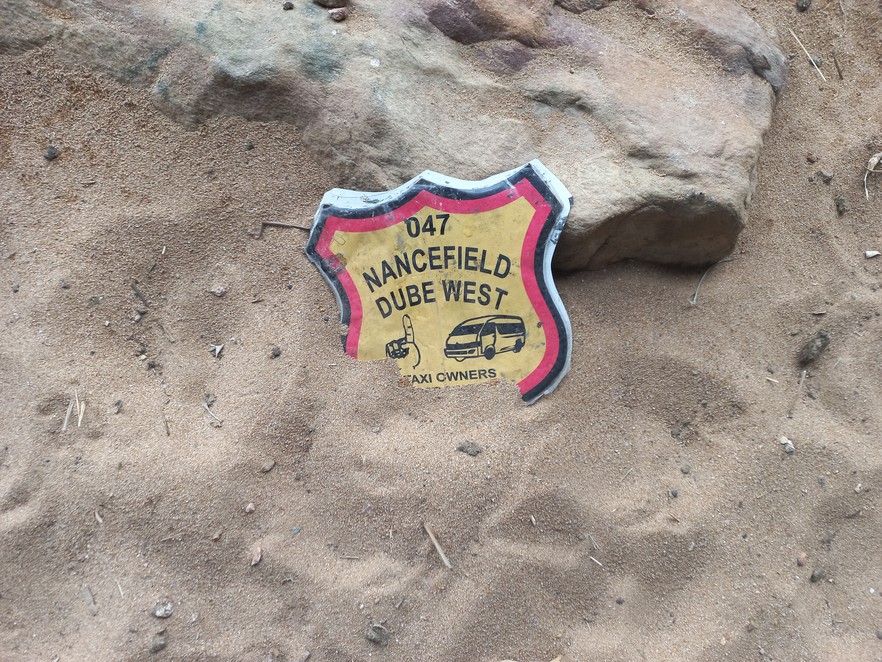
A taxi association medallion in the riversands alongside Klipspruit Valley Road.
A young man approached on the other side of Klipspruit road, walking a muscular, white-furred dog. “Pitty,” Maquina murmured, “I don’t trust Pitties.” The man ordered his pitbull to sit, and shouted across at us, “She’s very well socialised.”
Maquina made no effort to close the distance, so the man yelled out a question about tick control.
“You need to get Bravecta, and don’t wait. In fact if you come and see me just now I will help you,” Maquina offered, and the younger man thanked him and carried on.
“Literacy around pet ownership in Soweto is on the rise,” Maquina said.
The rain had stopped, and as the sun broke through the clouds, Loverboy started dry retching.
“That’s the thing about these riverbanks,” Maquina said. “You never know what your animal will ingest. There’s bones, faeces … all kinds of rubbish.”
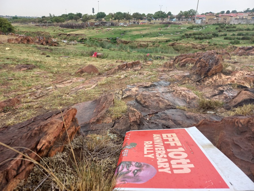
In Orlando the river reserve starts to feel pastoral, but its banks are heavily littered.
He excused himself from walking any further downstream, and steered his enormous hounds towards home. As they went, passing pedestrians froze and turned away from the sight, as if, said Mhlongo, “they believe they will become invisible if they do not look”.
Ahead of us, Klipspruit Road tracked the reed-fringed river down towards Eldorado Park. It had resumed raining, so we ended our walk at a nondescript Engen garage. An SMS came through from Maquina, who had taken our numbers.
Loverboy is fine, it read. The future is bright.
Support independent journalism
Donate using Payfast

Don't miss out on the latest news
We respect your privacy, and promise we won't spam you.
Next: Pensioner loses everything on Banxso
Previous: Murdered Cape Town taxi driver: family calls for probe
© 2024 GroundUp. This article is licensed under a Creative Commons Attribution-NoDerivatives 4.0 International License.
You may republish this article, so long as you credit the authors and GroundUp, and do not change the text. Please include a link back to the original article.
We put an invisible pixel in the article so that we can count traffic to republishers. All analytics tools are solely on our servers. We do not give our logs to any third party. Logs are deleted after two weeks. We do not use any IP address identifying information except to count regional traffic. We are solely interested in counting hits, not tracking users. If you republish, please do not delete the invisible pixel.

