Follow the water: tracing Lesotho’s uncertain water supply to Johannesburg
The long-term viability of the Lesotho Highlands Water Project faces various threats
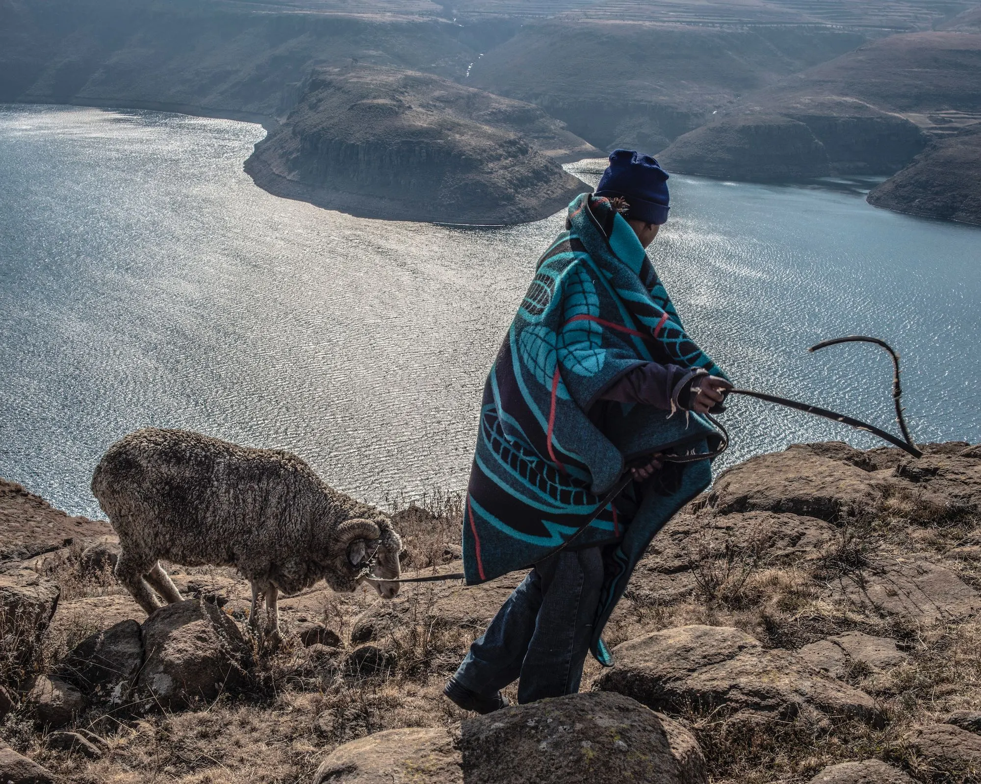
Shepherds GroundUp encountered in the catchment of the Malibamatso River were all from villages along the shoreline of Katse Dam, five days’ walking distance away. Flooding of Lesotho’s dams has led stockowners to keep their herds in the highlands all year long, in place of seasonal grazing. (The exclusive copyright on all photos in this article belongs to David Southwood. The photos are not published under our usual creative commons licence.)
Ahead of a six-month scheduled stoppage in supply from the Lesotho Highlands Water Project (LHWP), which provides water to approximately one fifth of South Africa’s population, GroundUp’s Sean Christie travelled to Lesotho to walk the river catchments of the LHWP. What he found should be alarming for anyone concerned with the long-term viability of the supply.
To say that Johannesburg depends on the Lesotho Highlands Water Project is putting it mildly. In June this year, the director general of South Africa’s water department, Sean Phillips, warned that Joburg is using water unsustainably, and could face a “day zero scenario” – a point at which municipal water becomes unavailable to residents, unless water use is dramatically curtailed.
Since it started operating in 2004, the LHWP has been the most consistent source of Johannesburg’s water, and when the LHWP’s next dam – Polihali – is completed in 2028, the LHWP will be the biggest supplier of water to South Africa’s urban highveld by some margin.
We went looking for the source of the largest of the rivers that flows into Katse Dam – the LHWP’s largest reservoir.
Katse – named for Poulo Katse, a philanthropic stockman who lived in a nearby village – is a Chinese dragon of a dam, snaking through Lesotho’s crenulated Leribe District for more than 50km, with rivers entering at multiple points. Two are significant: the Malibamatso, which enters at the head of the dragon, and the Bokong, which enters at its knee.
GroundUp went looking for the sources of the rivers that feed Katse Dam, the largest of the Lesotho Highlands Water Project’s reservoirs. Pictured here is the point at which the Bokong River enters the Katse.
Phalleng Lebesa recently retired from the Lesotho Highlands Development Authority. He had worked at conserving wetlands in the Lesotho highlands for much of his life, initially as an agricultural extension officer with the Department of Agriculture and later as a community outreach officer with the LHDA. He had been stationed at Katse Dam for many years. He said the Malibamatso was the largest river feeding it. To get to its source, he suggested starting from New Ox-bow Lodge on the Moteng Pass.
“The river passes the lodge, which is already at high altitude. We could make it to the source and back in two or three days,” he suggested.
My route to Lebesa’s home on the city’s southern outskirts passed through Thetsane, where a little river that goes under Kofi Annan road periodically runs bright blue with fabric dye from a textile factory upslope. This time it was merely gunky, but seeing it again made me think of some families I had interviewed in 2014 about their experience of being relocated to Thetsane from their villages in the highlands to make way for the flooding of Mohale Dam – the second of the major LHWP reservoirs to be constructed.
New homes had been built by the LHDA in Thetsane, but everyone I had spoken with had complained that the properties were structurally unsound, or lacked some or other promised service or amenity – grievances that were among thousands investigated and found to be valid by the country’s ombudsman at the time, Sekara Mafisa.
He exclaimed in a 2007 report that: “Once again LHDA … has manifested its true colours towards the problems it created for the people affected by its operations – cold insensitivity and callousness.”
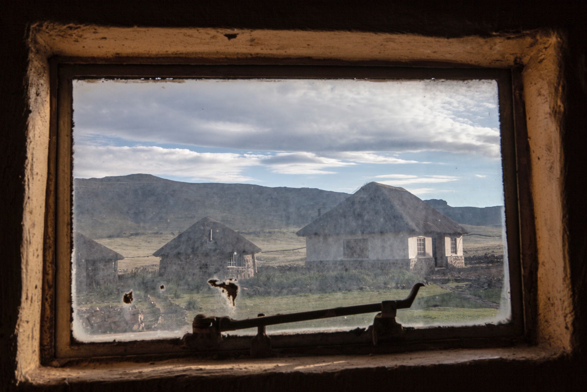
The Lesotho Highlands Water Authority built houses for families relocated from the dam sites, and promised running water and sanitation. In most cases the latter was never delivered and many relocated families who can see the dams from their windows do not have access to clean water.
It took several hours to wrestle free of Maseru and begin climbing into the highlands with Lebesa. We passed the sandstone quarries before Teyateyaneng, dubbed TY, fighting for road space with yellow taxis called 4+1s (four passengers, one driver). In Maphutsoe, we passed rows of shuttered textile factories.
“They were closed because the workers organised themselves and demanded higher wages,” Lebesa said. He’d heard that the erratic supply of water to the town had also played a role.
“When our taps run dry here in Lesotho, as they often do, we complain about the export of our water to South Africa, just as you South Africans complain about the export of your electricity when you are sitting in the dark.”
We crossed the Hlotse River and passed the turn for the Leribe dinosaur footprints, closely tracking the border with South Africa’s Free State Province. Beyond the turn for Muela power station the landscape tilts upwards. Towns cede to villages and what Basothos call the Blue Mountains suddenly grow tall.
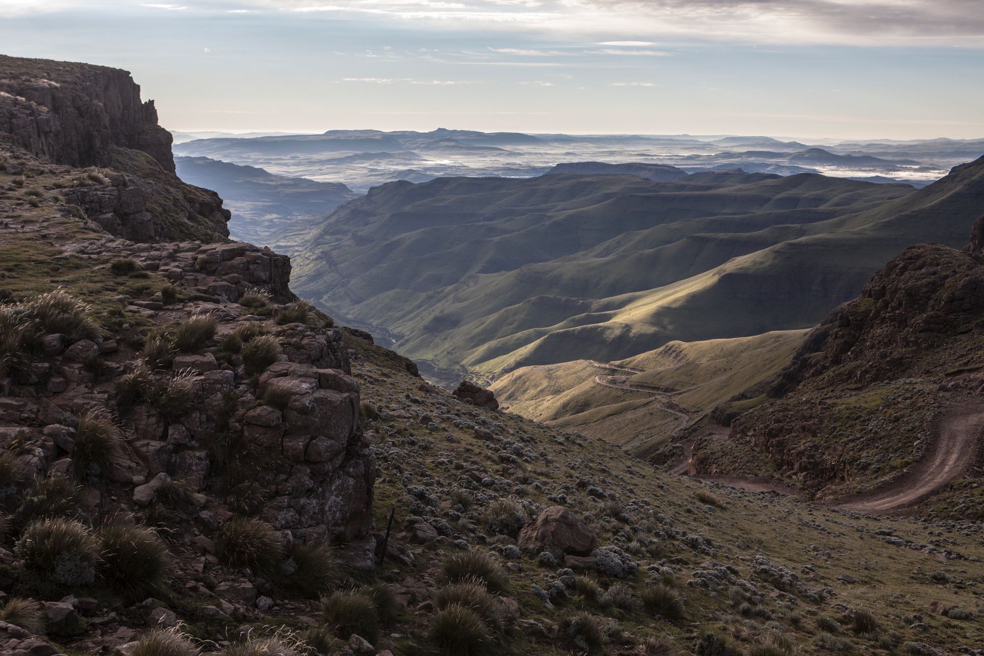
Our progress was again slowed, this time by road-building stop-and-gos. Lebesa explained it was to give the vehicles building Polihali Dam a better surface to travel on. The A1 remains the only road to the upper highlands. Before it was tarred the road was so bad that the government operated a flying service for people needing to come and go in a hurry, said Lebesa. Today, the peaks of the highlands can be reached by car from Maseru in just a few hours.
“It is cheaper today to bring food up from the lowlands than it is to cultivate it,” said Lebesa, pointing out fallow terraces on both sides of the road.
We continued on our snaking way, able to see the road below and above us. Among every Basotho work-crew was a hard-hatted Chinese foreman.
“These guys can really build roads,” said Lebesa. However, he pointed out some large erosion gulleys – canyon like – tracking away from the road, in large part the fault of the culverts that were used in the paving of the A1.
“They are simply too narrow for this environment, with its steep slopes and loose soils,” he said.
Until recently, the roads leading into the Lesotho Highlands were so bad the government operated a flying service for people needing to come and go in a hurry.
We passed Mutlanyane, the highest of the high-altitude villages on our route, before starting up the Moteng pass, which climbs alongside the Hololo river. From this point the A1 lies like a halter across the upper parts of the highlands, and at its apex two rivers – the Tshelenyana and the Malibamatso – converge. New Ox-bow Lodge is situated above this point, on the western bank of the Malibamatso. We reached it just as the sun peeled off a line of salmon-pink chalets. From the darkening reception area, we could hear water splashing in pools of smooth rock.
“Seems gentle,” I observed.
The receptionist shook her head.
“It is in low-flow, but when it rains the water comes down like a train,” she said.
Lebesa recalled a visit he had made a few years before to a village on the Malibamatso, on outreach for the department of agriculture. An old man had stepped forward to explain that, when he was young, everyone in the village knew that one could still cross the river after five days of rain, “but on the sixth day, you would not be able to cross.”
“Today, the old man said, the river is perilous after a single cloud burst,” said Lebesa.
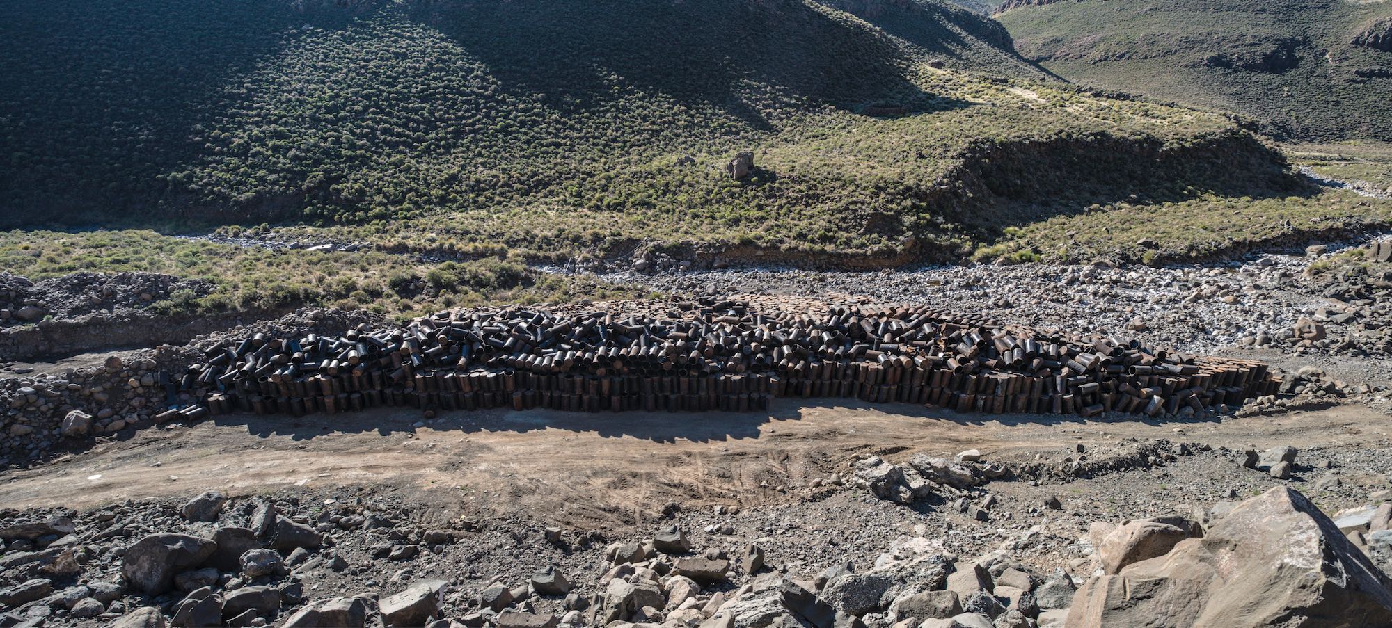
Two hundred gallon fuel drums, used to power the machines that built dams and roads in the Lesotho highlands, lie discarded in a riverbed.
Wetland destruction
We returned to the road, and found the sun again beyond the Mahlasela pass, dipping towards the hills beyond Afriski, Lesotho’s only ski resort. There are few things uglier than a ski lodge in summer, and Afriski is in the front rank of these blemishes with its single lift and brown, boulder-scraped slope. In the absence of snow, the valley was notable only for its cascade of small dams.
“There used to be a wetland there; who knows how this resort was approved,” observed Lebesa.
We continued along the road in the direction of the partly constructed Polihali Dam, stopping above a bowl in the hills. Lebesa led downslope towards a disc of green, which looked inviting in the otherwise uniformly brown and grey landscape.
“This is a valley bottom wetland, comprised of peat soils. Most of the wetlands in the highlands are valley bottom wetlands,” said Lebesa, who had been part of a LHDA team that attempted to rehabilitate it.
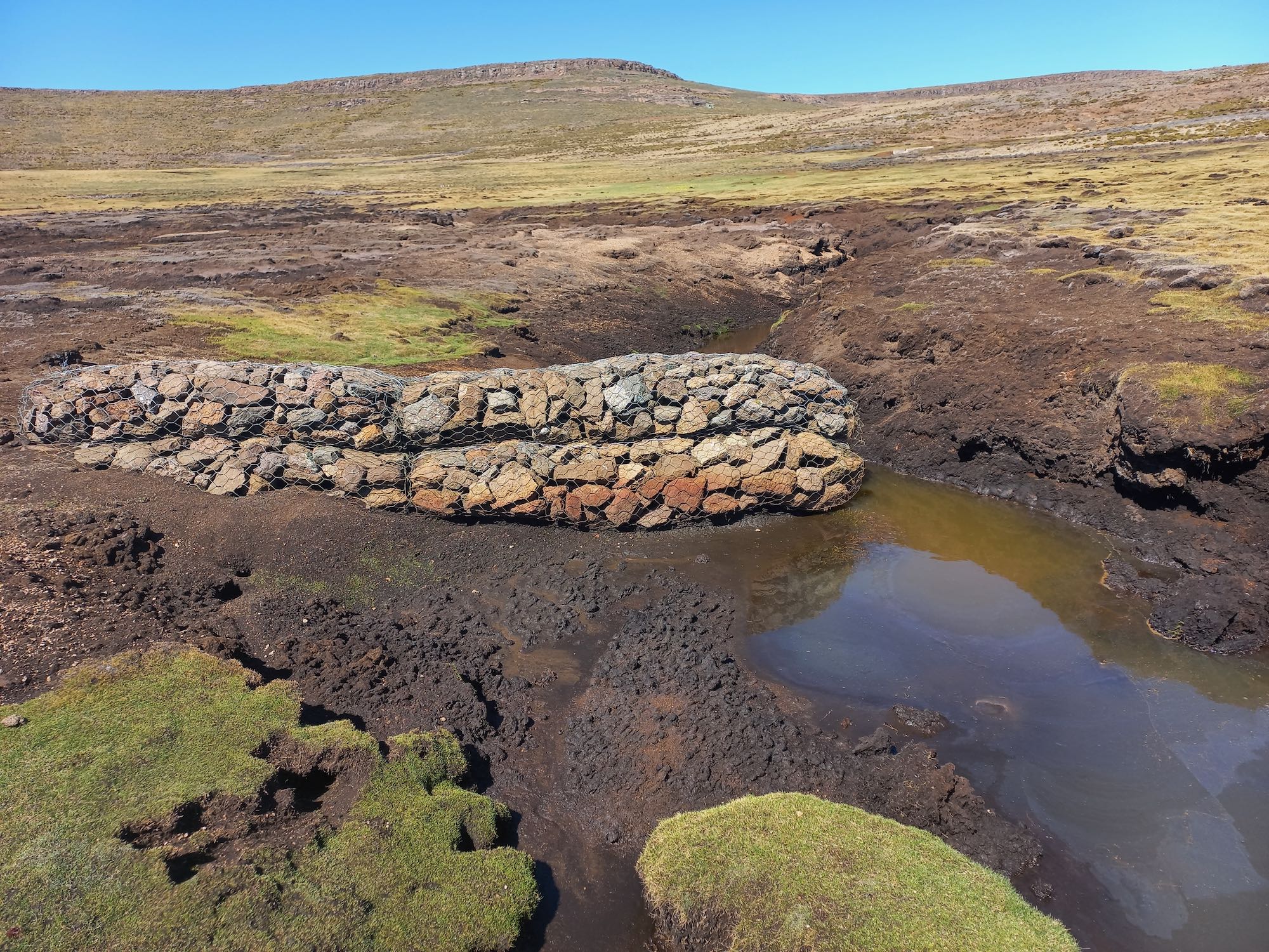
It was delightfully spongy underfoot, but a deep donga ran through the middle of the wetland. Gabion baskets had been placed in the donga at points but the water had bypassed these barriers and created a new channel.
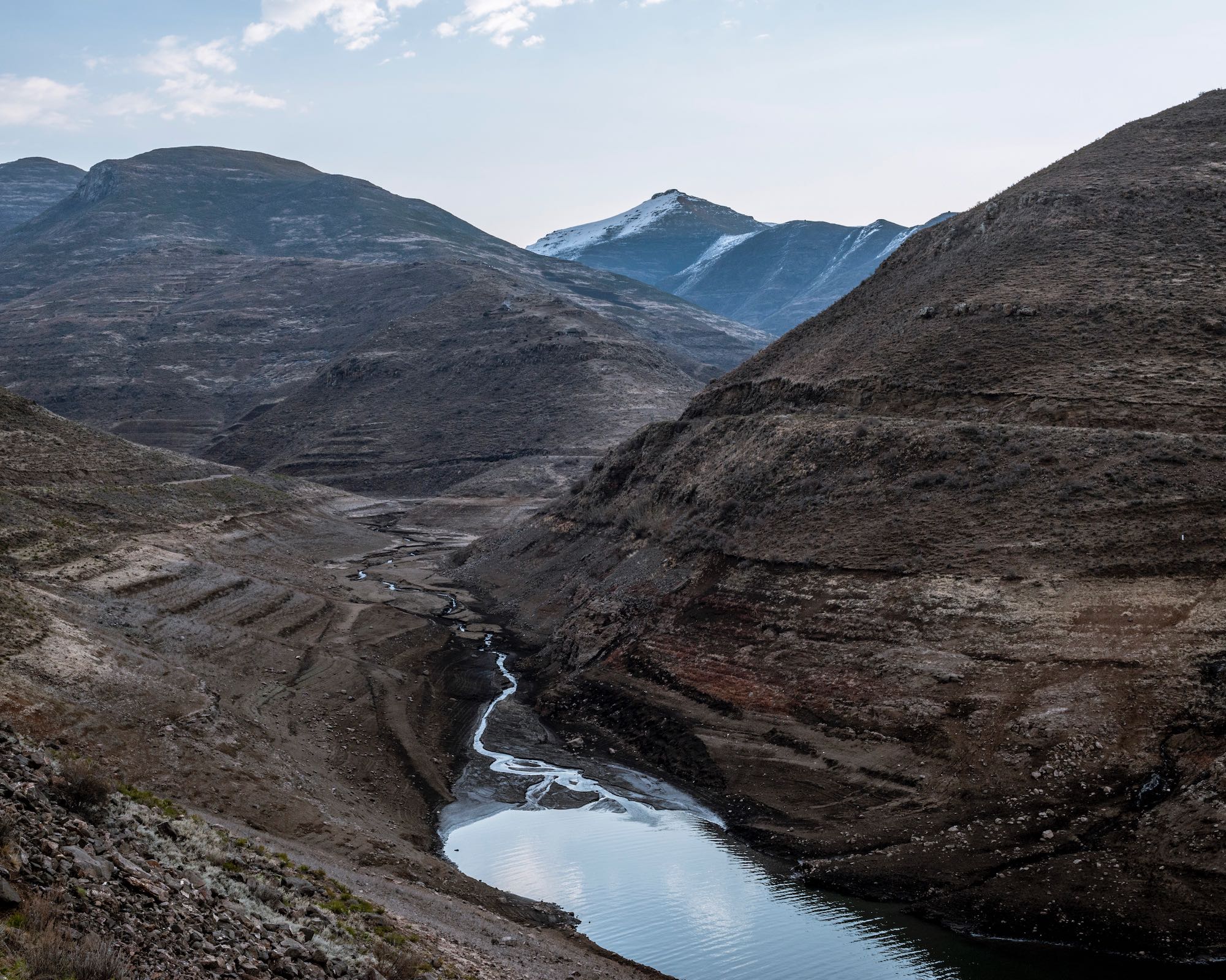
“A lot of the wetlands in the highlands look like this now. That’s why the rivers rise so quickly. In these mountains, wetlands are the brakes that slow water down and keep the topsoil from washing off into the dams.
“Well, our brakes are failing, and our dams are filling up with the highland’s topsoil!” said Lebesa.
A procession of 4x4s on the far side of the wetland had stopped and several people climbed out and approached us. After a volley of “dumelang ntates”, they said that they were scientists from a South African university, attempting to measure the impact of the very obviously compromised wetland rehabilitation measures before us.
“We worried you might be trying to steal our piezometers,” said Tsepo, a PhD candidate. Piezometers are geotechnical sensors that measure ground pore water pressure.
“Your piezometers are safe,” said Lebesa, “but you may as well remove them. We should be walking on water here, even at this time of the year. The fact that we are not tells you that this wetland is finished.”
The scientists looked a little crestfallen. All agreed that the condition of the highlands wetlands was concerning.
As we made our way back to the lodge in darkness, Lebesa confirmed that it is the LHDA’s mandate to care for the highlands river catchments, with a particular focus on the wetlands, but that all of the interventions that have been made since the mid-90s have been ineffective.
“I should know, I worked on most of them,” he said.
“If we continue to avoid dealing with the primary problem we will lose them all, every last wetland,” he said. “Tomorrow, you will see”.
Attempts to rehabilitate wetlands in the Lesotho Highlands have largely failed. As wetlands fail, water flows faster through the river catchments, stripping topsoil and depositing sediment in Lesotho’s dams. Photo: Sean Christie
Overgrazing and ice rats
At dawn the next day we stepped off the tarmac below Mahlasela Peak onto kinetic black soil, our legs pushing through a shin-high forest of bitter bush.
“We should be walking through grasslands but thanks to overgrazing this Chrysocoma (ciliate) has taken over. It’s the curse of the commons in action,” said Lebesa.
American scientist George Hardin’s seminal 1968 paper, The Tragedy of the Commons, is often referenced in relation to the Lesotho highlands. To illustrate his hypothesis - that people will, if left unchecked, consume resources with no regard for future generations – Hardin used the example of a freely-accessible sheep-grazing pasture, in which each individual stock-owner inevitably becomes, “locked into a system that compels him to increase his herd without limit – in a world that is limited”.
“Ruin,” writes Hardin, “is the destination toward which all men rush, each pursuing his own best interest in a society that believes in the freedom of the commons.”
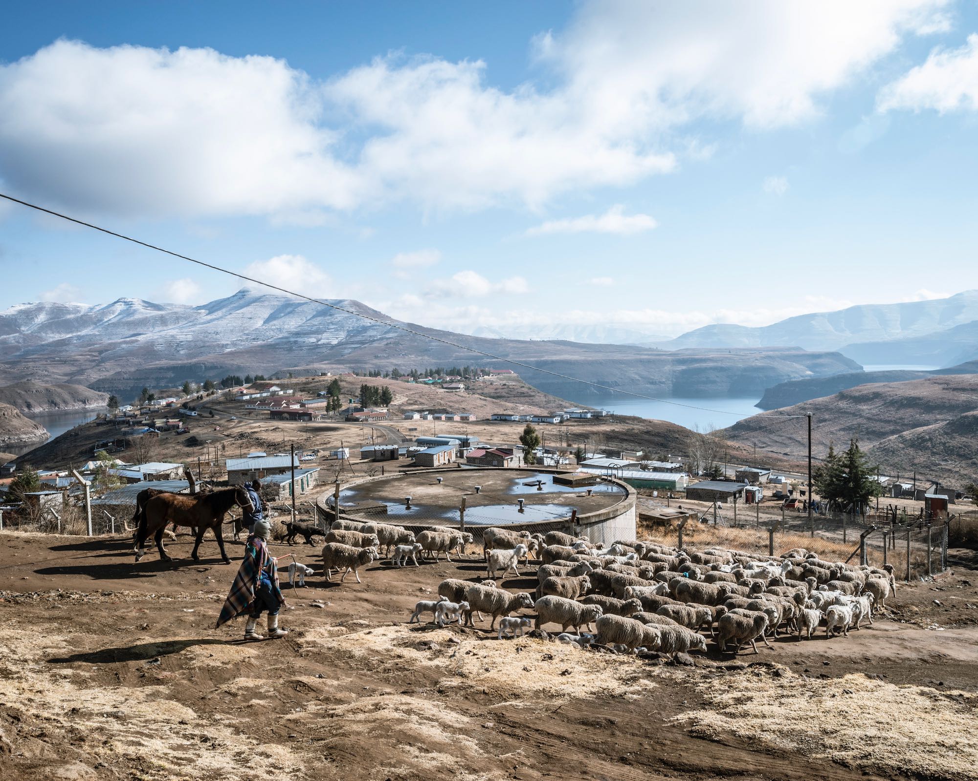
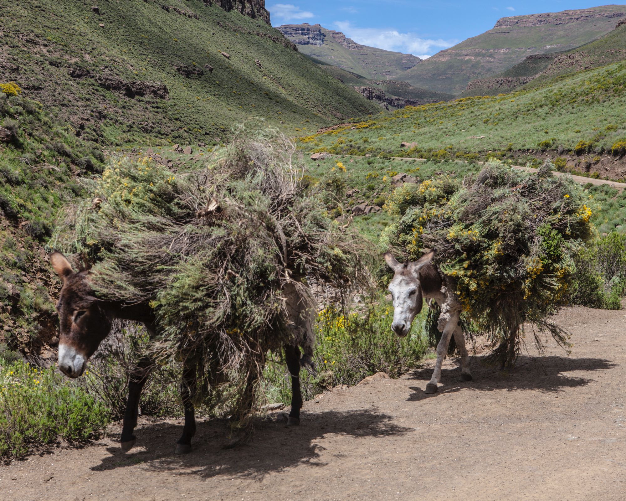
The Lesotho highlands is both limited and freely accessible to Basotho stockowners. Today, sheep tend to be grazed here all year round – cattle from the first of January, when the rains start.
Lebesa described this system of seasonal rotation as “old but fatally flawed, because the grazing areas get pounded just as new growth happens, so they never recover”.
We had been following a dry river channel down a shallow valley, and where it bottomed out there was a flat, more or less circular expanse, reminiscent of a cricket field in winter.
The soil, again, was delightfully spongy. It was also paper dry and perforated – a Swiss cheese of holes from which the heads of furry little creatures appeared and disappeared.
“Ice rats. You know your wetland is dying when these ice rats appear,” Lebesa said.
Peat holds water like a sponge. In a healthy peat wetland, Lebesa explained, the peat is permanently soaked. In a degraded, or dying wetland, the peat is drained by an erosion channel and becomes open to invasion by ice rats, whose burrows further degrade a wetland’s ability to hold water.
“They’re endemic but their numbers are on the rise. Most of the wetlands up here look like this. Most are dying, and many are already dead,” he said.
We continued along the channel to its intersection with a much broader valley in which a silver stream called the Matseng meandered. The landscape looked empty.
But what at first had looked like a smudge of grey rocks on a hillside gradually resolved into a series of rectangular kraal walls, with stone and thatch huts – “motebos” - above them. Ahead of us, sheep streamed across the face of the buttresses on the ridgeline, and a shepherd moved among them. We heard the low barking of dogs.
“Cattle posts,” Lebesa explained, “where herders kraal their animals at night. At this time of year only sheep.”
Overgrazing in the Lesotho Highlands threatens the sustainability of the Lesotho Highlands Water Project, on which approximately one fifth of South Africa’s population depends for drinking water.
Hard times for shepherds
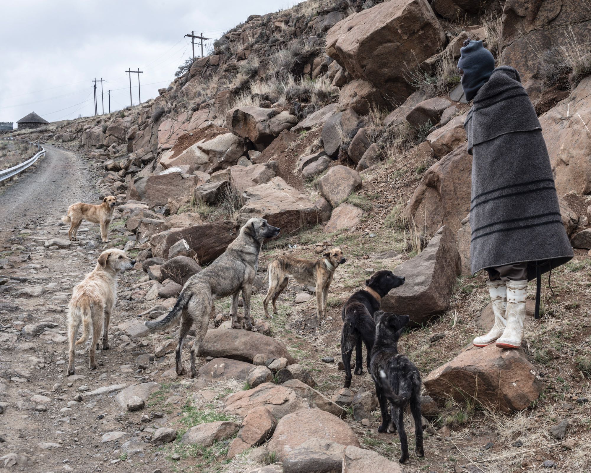
Among the many reasons to give these cattle posts a wide berth are the large guard dogs shepherds keep, reared to attack and responsible, apparently, for several fatal maulings over the years.
Lebesa grew up herding in the mountains above Mohale’s Hoek. He had attended school during the week but took his uncle’s place at the cattle post over the weekends.
“I loved it,” he said. “Being in the mountains with my friends, being responsible for the animals.”
We could see sheep in a stony bowl below the top of the ridgeline. Eventually we came across the shepherd. He turned to face us and reluctantly walked up the slope. He gave the name Neo. He pulled nervously with his fingers at the pinkish studs in his ears. Rubber bands – seals from the caps of 200-gallon drums discarded by the builders of the highlands’ dams and roads – were stacked on his right wrist, and he had a vial of clear liquid around his neck.
“For protection,” the boy said.
Herding, Lebesa explained, has become a dangerous occupation in the highlands, especially in the area we would be walking through, alongside the border with South Africa.
“Thieves will often kill herdboys to prevent them from calling for backup. They drive the animals over the range, down to QwaQwa [Phuthaditjhaba], where they are slaughtered immediately to prevent identification by brand, ear marking or lip tattoo,” he said.
According to Lebesa, violent stock theft has changed shepherding for good. Today, many stock owning families will not send their own children into the mountains, preferring to hire, or they will only send family members who are older. Neo was 20, and a hire.
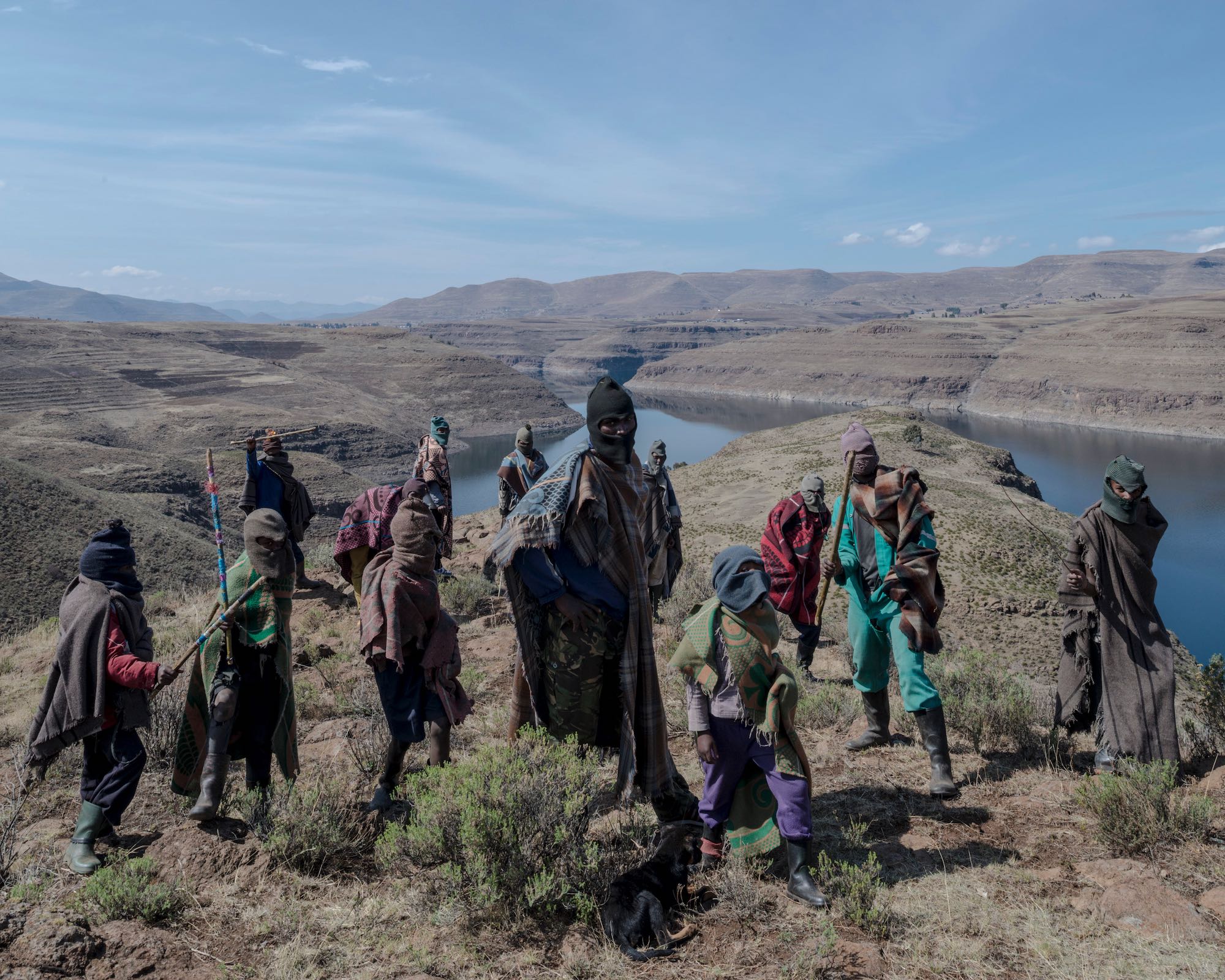
Violent stock theft has changed the practice of herding in the Lesotho highlands, especially along the border with South Africa. Herders today tend to be men, not boys. They are distrusting, and some carry arms.
“After six months, if nothing bad happens here, he will receive a handful of sheep. After a few years, he could have his own herd,” Lebesa said.
Lebesa considered himself lucky to have escaped this fate. His parents had left him in a remote village to be raised by his grandmother. His work in the mountains was considered a form of fealty, and some of his relatives argued that instead of proceeding to higher education, Lebesa’s place was in the mountains.
“Fortunately, one of my uncles who’d received an education overruled them. He was my champion,” said Lebesa.
Neo confirmed that we would soon reach the source of the Malibamatso, but he warned us that there were cattle posts all the way down the river valley, many of them occupied. He said anyone we encountered would be extremely jumpy, as some herders in the area had been killed and decapitated not so long ago, their bodies mutilated by their own starving dogs. Following the river back down to the lodge was not something we had contemplated, but it seemed the way to go, if we could make it back before dark.
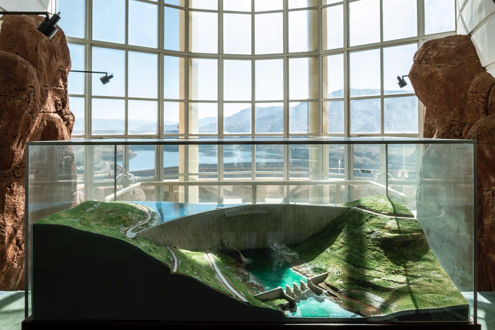
A glass enclosed maquette of the wall of Katse Dam, in the now closed information centre.
We took lunch on the ridgeline, looking down at the two initial stems of the Malibamatso, divided from each other by a rocky spur. We decided to descend into the nearest valley, towards another flock of sheep. To avoid us, their shepherd disappeared upslope and hid behind some boulders.
The start of the river channel was dry and remained so for quite a distance. Then, for no discernible reason, water was present in unmoving pools. Beyond this it was trickling, and then it streamed through earthy chutes.
At the confluence of the two river stems there were surprisingly deep pools in the wetland, one clear, the other muddied by hooves and muzzles.
Three dogs came creeping towards us, and a shepherd came at them swearing and throwing stones. One by one they moved off and lay down. The shepherd approached and introduced himself as Mountsi Burotho from Haberi village, not far from the wall of the Katse Dam. Lebesa knew the place, and Burotho recognized Lebesa.
“I did some rehabilitation work in the area and hired some of the men and women from his village.”
“It’s a long way off?”
“About five days’ walk.”
Abuthi Neo and his fellow herders from the other side of the ridgeline had also come from villages on Katse’s long shoreline, and Lebesa reckoned that their presence in this distant area of the highlands was possibly a consequence of the flooding of rangelands closer to home, although he warned it would be too easy to blame overgrazing in the highlands on the Lesotho Highlands Water Project.
“Everyone knows it is the result of the sort of tenure system we have here, and that the solution is to keep herders out of the highlands, but as long as our politicians need this,” Lebesa said, wagging a long voters’ forefinger, “I cannot see this happening.”
Many stock owning families will not send their own children into the mountains, preferring to hire shepherds.
Silting
Burotho reckoned we would have to push to make it off the river by nightfall, and so we increased our pace and limited our stops. The river now snaked this way and that through the increasingly deep valley. We found ourselves looking down at the glinting water from a cliff’s edge, when it seemed we had just been at the river’s side. We back-tracked, descended, continued on our way.
To avoid cattle posts we crossed and re-crossed the river, palm-length brown trout leaping at our ankles in their haste to get away. There were now cattle posts above most bends in the river, most unoccupied.
“The only living thing here is bed bugs,” Lebesa said, as we passed by the entrance of a motebo [shelter]. A fire had swept up the valley earlier in the year, and our boots crunched over the remnants of caterpillar grass.
“Very nutritious”, said Lebesa. Mostly we crunched down on Bitter bush, that denizen of degraded soils.
We maintained our elevation, the river a distant presence on the right, or left, and now mostly in the shadow of the cloud topped peaks.
A conical monitoring station stuck up below us in the fading light.
The LHDA supposedly observes the rivers, collecting data on flow rates, sedimentation and more, but whatever data it has is kept confidential.
“I don’t have figures but anyone who knows the highlands will tell you that the rivers are lower than ever, except when it storms and they come down in terrible flood. When this happens the water is full of soil, which ends up in the dams,” he said.
I asked him how long it would take for the dams – the most important source of Johannesburg’s water – to fill up with silt.
“It’s your grandchildren’s problem,” he said. “The length of the rivers that go into the dams is short, which limits the amount of soil that washes in, but the important thing is that they are the highest dams in all of Africa. Once they’ve silted up you can’t build new dams at a higher altitude, and there are no dam sites lower down.”
We crested another ridge, stumbled down the other side, crossed under electricity pylons and found a chute we could safely descend in sliding waves of sand, to reach the road.
Walking along it in stillness, we came to the bridge over the Malibamatso and saw the lights from Ox-Bow lodge illuminating the next bend in the river, and the water continuing along its way bound, ultimately, for Johannesburg and surrounds.
For how long though, nobody seems able to say. Probably not in our lifetime, but in the long view of human history, very soon Lesotho’s dams will silt up, and the Lesotho Highlands Water Project will no longer be able to meet South Africa’s demand for water. Conserving Lesotho’s wetlands should be a priority for both countries. It is not.
This is part of a series of articles on the LHWP and Johannesburg’s water supply. The views of authorities such as the CIty of Johannesburg, LHWP and Lesotho government will be sought for future articles.
The protection of the Lesotho Highlands is deemed vital, not least to the sustainability of water supply to the Lesotho highlands Water Project.
Support independent journalism
Donate using Payfast
![]()
Don't miss out on the latest news
We respect your privacy, and promise we won't spam you.
© 2024 GroundUp. This article (but not the photos) is licensed under a Creative Commons Attribution-NoDerivatives 4.0 International License.
You may republish this article (but not the photos), so long as you credit the authors and GroundUp, and do not change the text. Please include a link back to the original article.
We put an invisible pixel in the article so that we can count traffic to republishers. All analytics tools are solely on our servers. We do not give our logs to any third party. Logs are deleted after two weeks. We do not use any IP address identifying information except to count regional traffic. We are solely interested in counting hits, not tracking users. If you republish, please do not delete the invisible pixel.